Merlin Castle in 3D – History Meets Technology
Exploring the history of Merlin Castle and how I recreated it using drone photogrammetry and Agisoft Metashape.
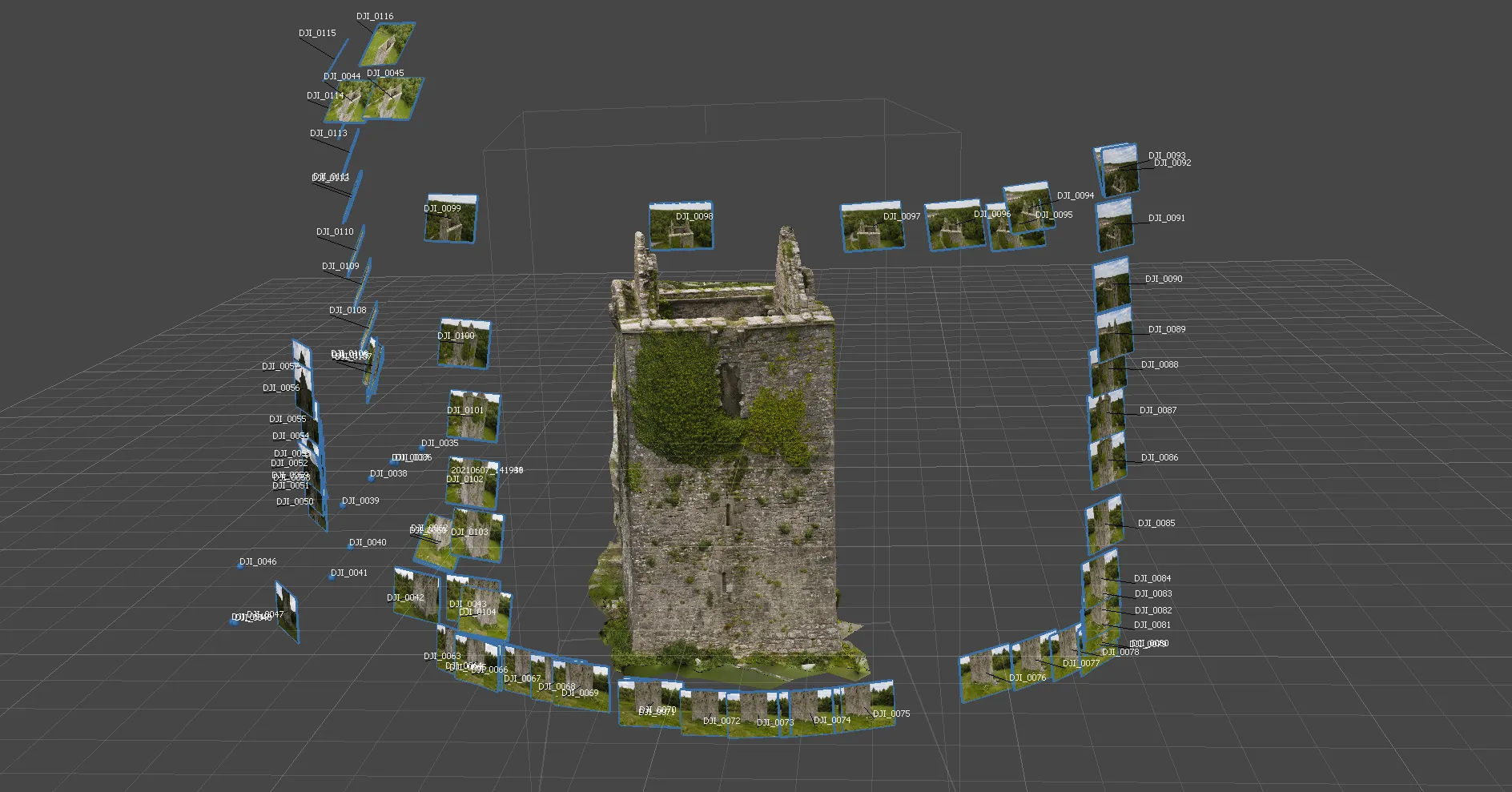
3D model with associated input images captured with the drone
You may be wondering what it is you're looking at in the background. Just a short walk from the edge of Galway City, Merlin Castle (or Caisleán Mhuirlinne as Gaeilge) sits quietly in the woods, its weathered stone walls and ivy-covered tower echoing a bygone age. Built in the 15th century and likely linked to the Lynch family, the castle once served as a fortified home, overseeing the lands around what is now Merlin Park.
To preserve and share this piece of local history, and as one of the first projects I had in mind for the drone, I created a dense point cloud 3D model of Merlin Castle using drone-based photogrammetry. After capturing (almost!) a full set of high-resolution aerial photos, I processed them through Agisoft Metashape to align, mesh, and texture the structure with photorealistic detail. The result is an interactive model that brings the site to life digitally, in the background of this page. Unfortunately its creation was cut short by the arrival of a small family to the area on the day, so in the interests of their leisure and safety, I've missed out on the far facade. One to come back to I guess, but it was early days in my exploration of Photogrammetry, so it was never going to be perfect.
This kind of digital heritage work combines fieldwork, creative tech, and a fair bit of trial and error. It's part of my wider goal with this site: blending history and innovation to create immersive, visual experiences that help us explore the world in new ways.
Head back out to the homepage and use the gallery button on the bottom-right to check out the model in more detail!